
A terrain model’s scale connects a real landscape to a display people can approach. Start with the question the model must answer: the shape of a mountain, the relationship between proposed lots, the route through a golf course or the history of a river valley. Then decide how much land belongs in the view. Those decisions set useful limits on the scale.
Begin with the area and the available footprint
Measure the landscape’s width and depth and the usable model area, excluding its frame or border. Divide each real dimension by the matching available model dimension, using the same units. The larger result is the minimum scale denominator that lets the whole area fit. Leave room for any labels or display elements before treating that number as the final scale.
For example, a site 6,000 feet wide is 72,000 inches wide. On a 40 inch model surface, 72,000 ÷ 40 = 1,800, so that dimension fits at 1:1,800, also written as 1 inch = 150 feet. If the site is 4,500 feet deep and the surface is 30 inches deep, the depth calculation gives the same result. A frame added outside that surface increases the overall display size.
Check the smallest feature that matters
Scale determines how much space a feature has on the model. At 1 inch = 150 feet, a 15 foot wide road occupies 0.1 inch. That calculation does not promise that every surface or detail can be represented exactly; it tells you what to discuss with the model maker. Consider the fabrication method, contrast, labels and normal viewing distance together.
On a detailed golf course terrain model, a green’s shape or a slope may matter to the presentation. A course layout map for a golf shop or wall display has a different purpose. Decide whether the audience needs fine relief, recognizable hole routing or the course’s position within a larger development. Our golf course models page shows these different applications.
Calculate relief before choosing exaggeration
With equal horizontal and vertical scales, a real elevation difference of 300 feet becomes two model inches at 1 inch = 150 feet. That is an illustrative calculation, not a recommendation for every landscape. A regional model covering much more ground may reduce modest hills to shallow relief.
Vertical exaggeration multiplies the height relative to the horizontal scale. If those two model inches are exaggerated three times, they become six inches. Keep the horizontal scale and exaggeration factor explicit in the display information. A viewer should be able to understand that the model’s height and horizontal distance use different proportions.
Use the exhibit’s purpose to guide the choice
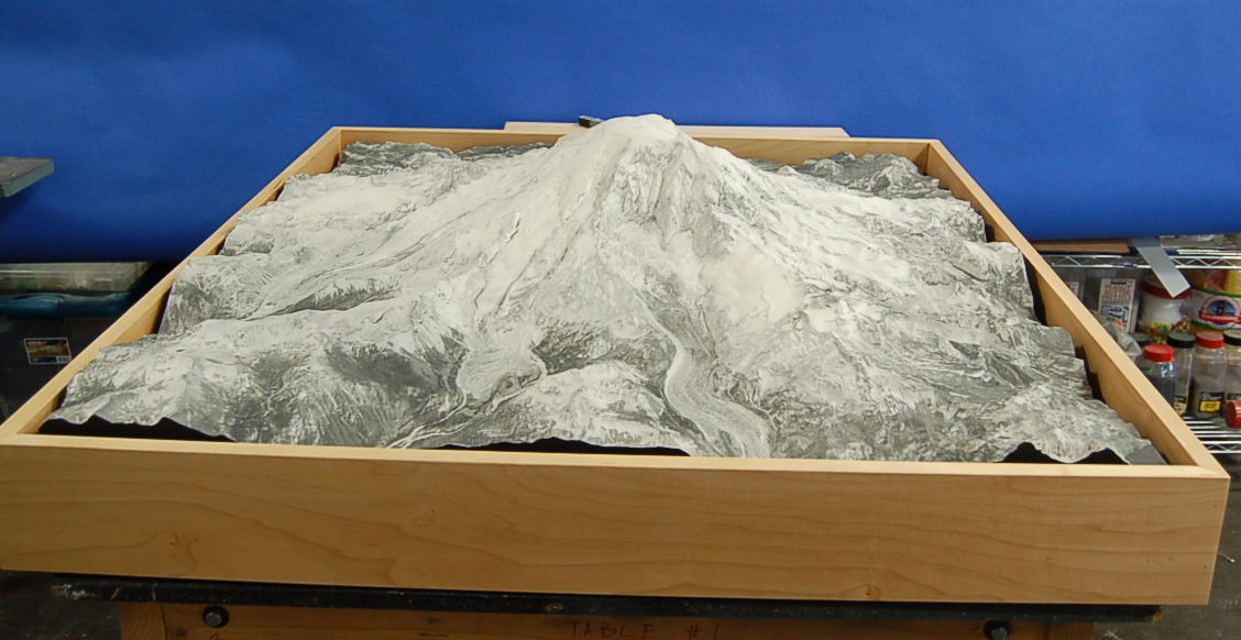
The St. Charles Heritage Museum model uses 1 inch = 600 feet horizontally with threefold vertical exaggeration. That choice makes subtle landforms easier to see across a historic landscape. The Mount Rainier model shares a horizontal scale of 1 inch = 1,500 feet with its Mount St. Helens companion, giving the pair a consistent basis for comparison.
These are different reasons for choosing scale. A single large model does not always have to carry both a regional overview and a close study. Separate models, removable sections or a smaller area of coverage may serve the explanation better. Discuss those options before adding height simply to make the terrain more dramatic.
Account for viewing, installation and transport
Check how closely visitors can approach, whether they can see all sides, and how the model will enter the room. Include the base, cover and packing arrangement in the size discussion. A display built in sections may suit a large site, but the joints and assembly plan need attention early. Our transport guide covers the practical questions.
What to send for a scale discussion
- A marked boundary and real dimensions of the area.
- The available model surface and overall display space.
- The elevation range and source data, if available.
- The smallest features the audience must recognize.
- The expected viewing distance, labels and travel requirements.
Use the elevation data checklist to assemble the land information. Archetype3D can then help choose a scale that supports the story, the physical detail and the display setting.
Common questions
How do I calculate a terrain model’s horizontal scale?
Convert the real and model dimensions to the same units, then divide the real dimension by the model dimension. Check both width and depth and use the larger denominator so the selected area fits.
Does vertical exaggeration change the horizontal scale?
No. It changes the height relative to the horizontal scale. State the horizontal scale and exaggeration factor together so viewers can interpret the relief.